Maps
The Map Collection of the National Library holds most maps of Iceland that have been published during the ages. Most of these maps have been acquired through the legislation on legal deposits.
The Map Collection in located on the 1st floor and it is one of the Special Collections of the National Library. The largest part of the Icelandic maps are from Danish survey project of the country during early 20th century (herforingjaráðskortin), maps from the British and US-Army from the middle of the 20th century (AMS-maps), publications of the National Land Survey of Iceland and other publishers. The Map Collection also contains a large collection of books (about 600 volumes) on maps and cartography which it received as a donation from Haraldur Sigurðsson and his wife Sigrún Á. Sigurðardóttir. In that collection one can find copies of atlases of the finest cartographers of earlier centuries, many works by respected scholars in this field as well as the main journals on maps and cartography.
Íslandskort.is
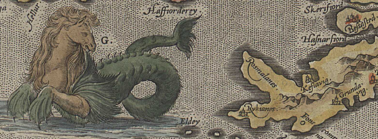
Historical maps of Iceland
Ask a Librarian_
Please introduce yourself by adding name and email.
The chat is open 9:00 - 16:00 on weekdays.